By Erin Bregman Every Tuesday morning, members of the Earth Science Project Office gather around…
NASA’s Student Airborne Research Program Inspires the Next Generation of Scientists
By Jane Berg

Logo embroidered into the seat covers on the DC-8 jetliner, also known as the Airborne Science Laboratory. Image: Jane Berg.
Despite my noise-canceling headset, the whirring engines are still very loud as NASA’s Airborne Science Program plane taxis away from the Armstrong Flight Research Center in Palmdale, California. Overhead, a green LED flickers. The numbers on several small digital clocks surrounded by cables, tubes, and wires are trembling furiously. The pilot’s voice on the intercom is efficient and tinny as he asks for a final verbal confirmation from the dozen or so NASA and NOAA research scientists who each respond with a quick “ready.” There are a few instances of “let’s go” and “let’s do this,” topped by a final “rock and roll.”
This isn’t your average airline departure, it’s the penultimate flight of a three-day airborne research campaign that will gather vital data about air quality over the ocean and major cities of California. Up until a few minutes ago, people were scurrying around adjusting vents, dials, and canisters; but there’s none of the stressed and impatient mood you find in a cabin crammed full of people who have better places to be. Here, the plane is the destination.
Left: A pilot uses the DC-8 intercom. Right: One of the instruments on board the DC-8. Images: Jane Berg.
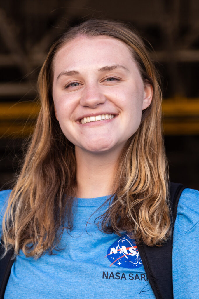
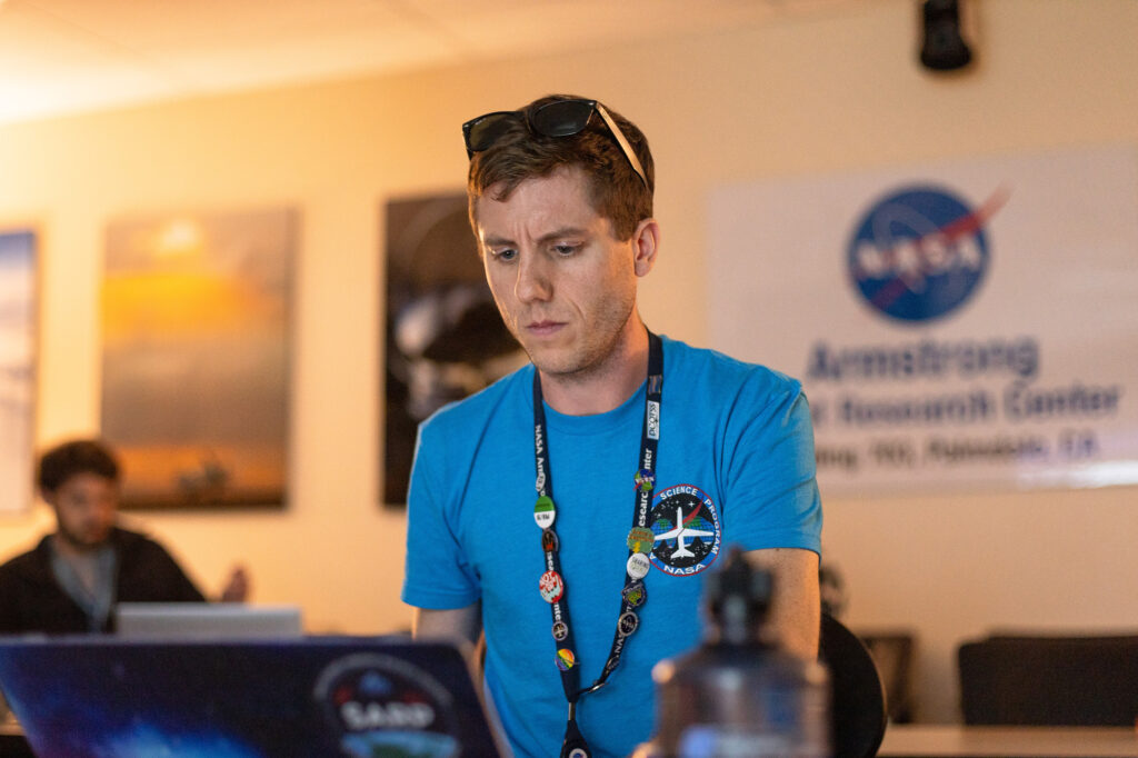
As we pick up speed and launch into the air, I begin to feel the first twinge of motion sickness. I glance behind me and try to catch the eye of Christy Harper, who is sitting with a researcher looking at an air-sampling instrument. She doesn’t seem to be getting air sick, possibly because she has already flown a couple times this week. Harper is one of 24 interns taking part in NASA’s Student Airborne Research Program (SARP). Today, I’m experiencing the “airborne” part of the program. It’s the highlight of an eight-week-long summer internship in which undergraduates in the STEM fields can get in touch with how real data are collected during a research campaign.
The program has been running for 13 years, has trained over 400 students, and is both objectively successful and genuinely cherished by everyone involved. I spoke with a few students before the internship began, and they certainly sounded excited, if a bit apprehensive about what lay ahead. First, the students travel to Palmdale, where they attend a week of lectures that get them up to speed with the campaign’s research objectives and methods. Next, the students take part in the flights and other trips into the field. Finally, they head to University of California, Irvine, where they spend the remaining six weeks crafting an individual research project and presentation.
“There’s no other opportunity like SARP,” says Harper. “There are a lot [of internships] out there, but not many where you get the hands-on experience of going on a flight, working with the data that you found, and doing something with [them] at the end.”
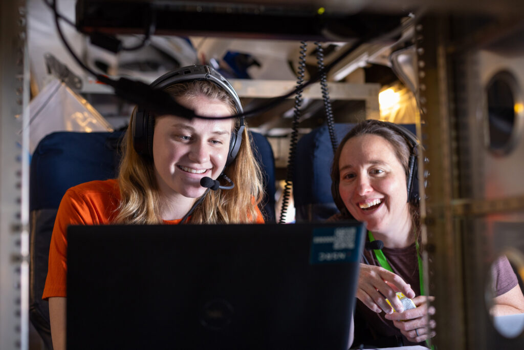
Left: Christy Harper, a rising senior at Bowling Green State University in Ohio. Right: Harper operates one of the instruments on board the DC-8 with the guidance of research chemist Rebecca Schwantes during a research flight over the Los Angeles Basin and Salton Sea. Images: Jane Berg.
But what makes these research flights different from the mundane mode of transportation we all know well? And what is “airborne science” anyway? These were the questions on my mind as I tagged along for the ride. I didn’t expect that following these students would give me a unique view into how NASA and NOAA study society’s impact on the air around us.
The Airborne Science Laboratory
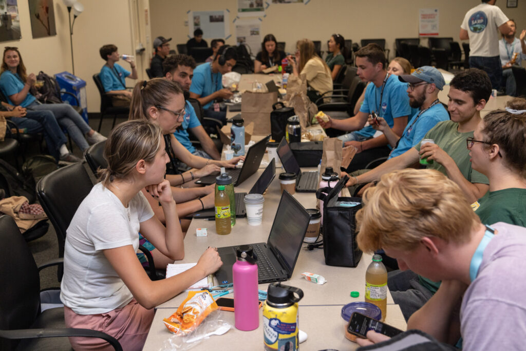
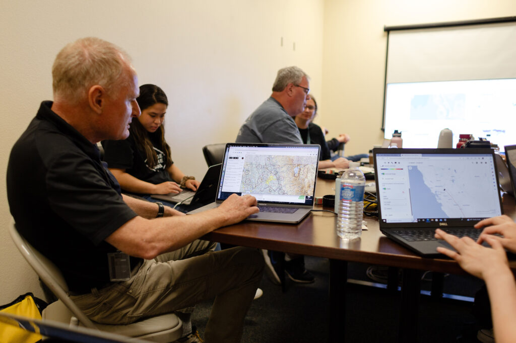
SARP students eat lunch in a conference room in Building 703 at NASA’s Armstrong Flight Research Center. Image: Jane Berg.
Pre-flight briefings, held in the crowded conference room next to the aircraft hangar, are the one time each day that everyone is present: SARP interns, mentors, and faculty advisors, along with scientists from NOAA, NASA, BAERI, and independent researchers. Standing up at the front are the pilots in their tan jumpsuits. Over to the right, I can see program scientists Barry Lefer and Melissa Yang: they’re in charge of making sure the mission objectives actually get accomplished. There’s also a mission meteorologist who keeps the team up to date with the day’s weather.
Many of the scientists are here with NOAA’s Atmospheric Emissions and Reactions Observed from Megacities to Marine Areas (AEROMMA) campaign. Others are from NASA’s Synergistic TEMPO Air Quality Science (STAQS) mission, which aims to integrate observations from a new NASA satellite called TEMPO with traditional air-quality monitoring. In essence, both campaigns are investigating how various emissions affect the troposphere. That’s the lowest layer of Earth’s atmosphere; it’s where weather happens and includes the air we breathe. Campaigns like STAQS and AEROMMA are comprehensive and complex, to say the least, requiring months of project-management support from BAERI and NASA folks at NASA’s Earth Science Project Office. The SARP students and I have arrived right when all those efforts come to fruition and when the flights and fun get started. The hope is that by seeing science at its most active and not as data points on a computer screen, a number of students will leave here bitten by the Earth science research bug.
Returning to the pre-flight briefings, after the pilots and the mission scientist announce the day’s schedule you can’t help but feel a rush of adrenaline when your name is called as they read out the flight manifest. Then there is a lot of nervous commotion as people break up and students rush over to write their names down for a turn sitting in the cockpit. The mentors marshall their groups and escort students past cryptic warning signs for “fire pit” and “active lasers,” leading them down to the aircraft hangar.
Students are escorted through Armstrong Flight Research Center’s hangar. Image: Jane Berg.
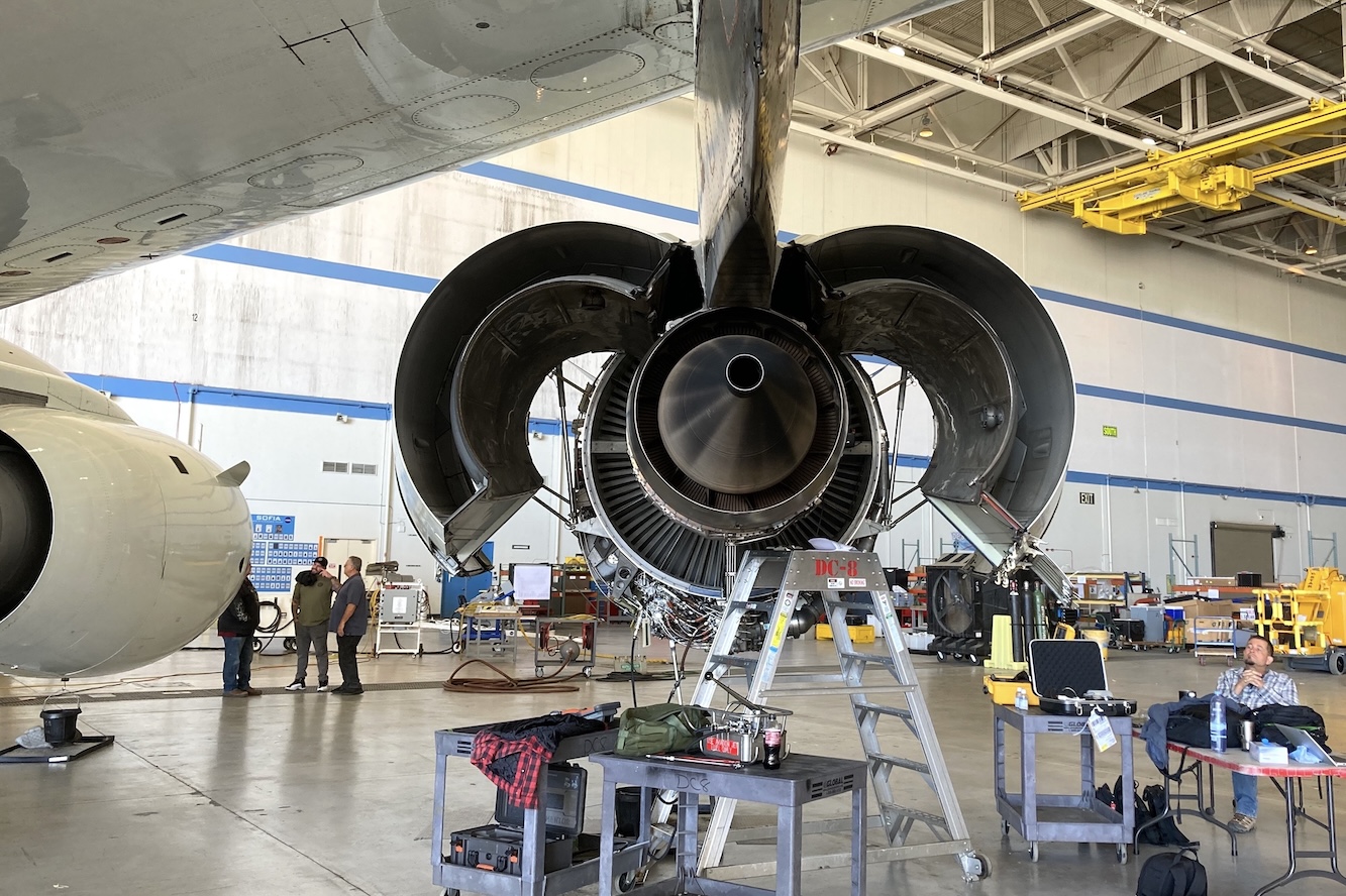
The central hangar area is a vast 210,000 sq ft cathedral of concrete and sheet metal that makes the trailers and shipping containers that are sitting inside look like LEGO blocks. And there, waiting against the blue sky, is the star of the campaign, the NASA DC-8 jetliner, also known as the Airborne Science Laboratory.
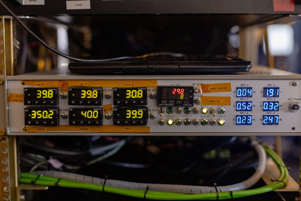
The DC-8 is a venerable 1972 four-engine jetliner that has been modified by NASA to become a flying laboratory, one that can carry up to 30,000 pounds of equipment. Some of these scientific instruments can be worth half a million dollars and are housed inside large steel containers. These heavy duty metal boxes are crammed full of wires and tubes that range in size from a cocktail straw to under-sink plumbing. Some poke into the plane’s modified window ports, parts of a process called whole air sampling (WAS), which is used to detect whatever gases are present in the air. During the flight, a scientist on the WAS team can choose the best moment to open a valve and allow air to be sucked through the pipes and into canisters that are offloaded after the flight for analysis.
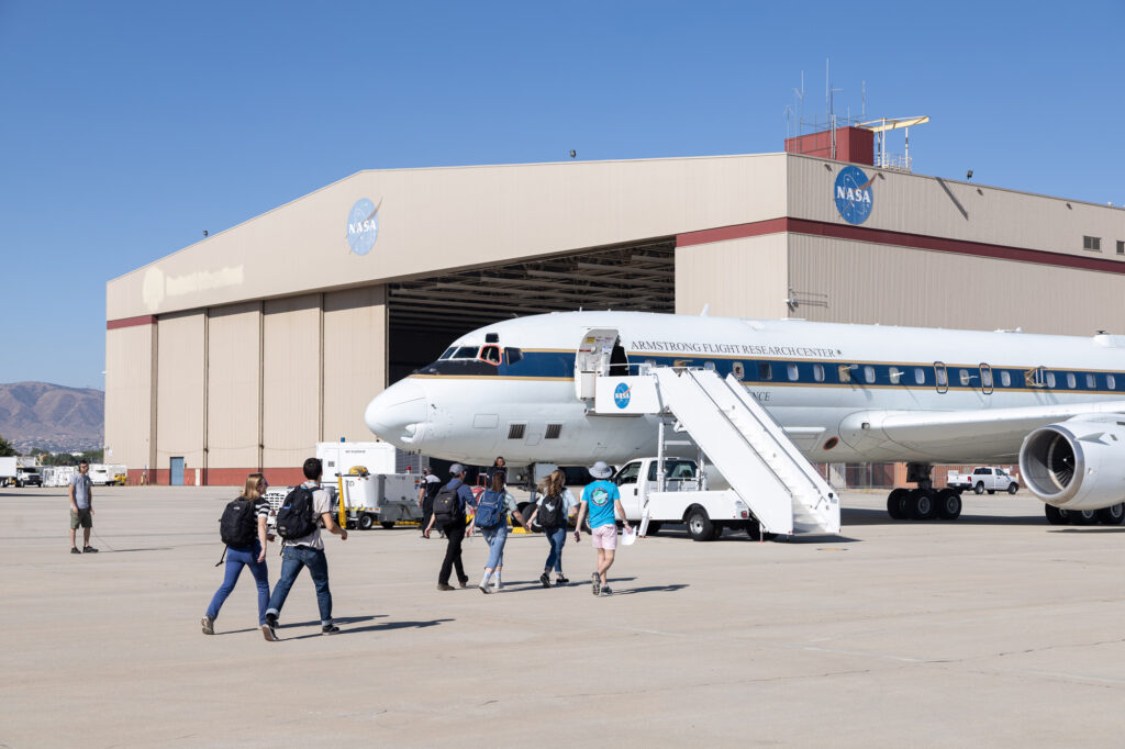
Ryan Bennett, manager of SARP 2023, leads students onto the DC-8 for the first science flight. Image: Jane Berg.
There is also a range of other devices, like the aerosol mass spectrometer, which uses lasers to obliterate aerosols (tiny particles in the air) so that their mass can be analyzed. Due to the complexity of the instruments and the importance of each measurement, the students don’t operate the hardware. But they do accompany and observe the scientists, who explain the process and sometimes let the students flip a switch. Even though students aren’t in charge of the instruments, they can still study the results. Over its first 12 years, SARP flights totaled 165 hours, collecting millions of measurements of atmospheric gases—data that have led to 20 peer-reviewed publications, several of which have SARP undergraduates as first authors.
Increasing Access to Earth Science Opportunities
All the students will get to fly on the DC-8 at least once. There’s space for about a dozen students per flight, while two smaller aircraft, the Gulfstream III and the Gulfstream V, can each accommodate one or two students. This year is the first that SARP has used three planes working together to gather data.
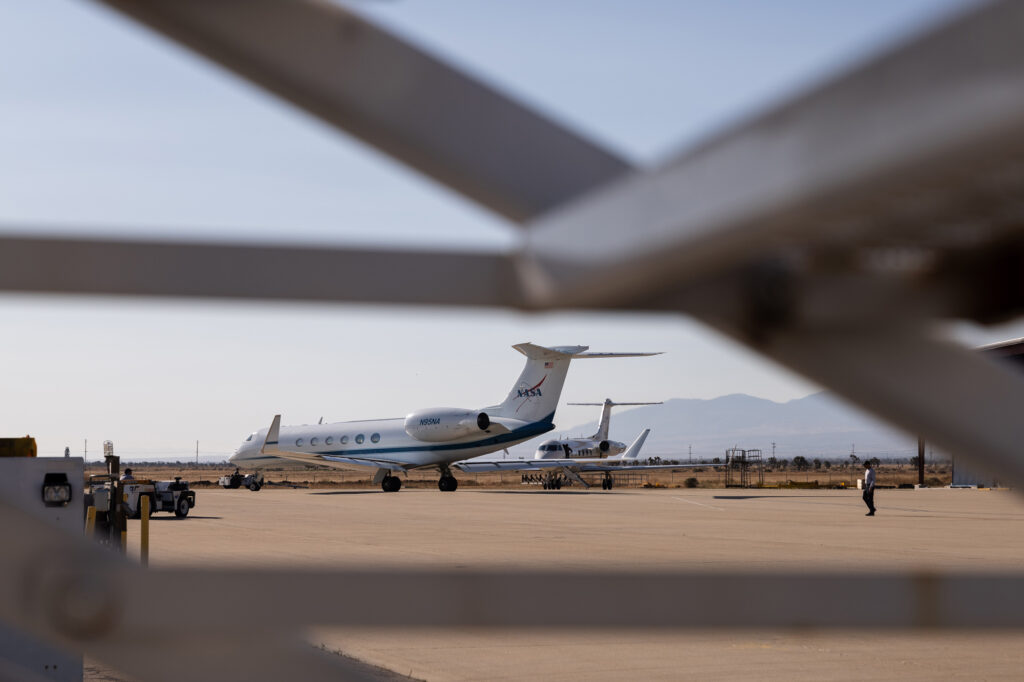
The Gulfstream III and the Gulfstream V prepare to depart the Armstrong Flight Research Center. Image: Jane Berg.
“SARP is complicated enough with one plane, but with three it’s even more intense,” says BAERI’s Ryan Bennett, SARP’s program manager in 2023, which made him that summer’s “SARP Dad.” And like a busy single parent, he is working flat out to manage a packed schedule: arranging NASA entry badges and escorting newcomers, organizing the flight manifest, coordinating with faculty and mentors, and keeping weekends filled with activities like hikes and poolside pizza parties.
In another life, Bennett taught high school mathematics, and so he’s familiar with the challenge of creating a supportive group dynamic among people who come from all walks of life. One of SARP’s central goals is prioritizing students who don’t study at tier-one research institutions. From 2009 to 2021, students came from 238 schools, ranging from small liberal arts colleges to large universities and also minority-serving institutions across 50 states and Puerto Rico. Something that Bennett says he looks for when going through applications is whether the internship would give someone an opportunity they wouldn’t otherwise get.
BAERI’s Ryan Bennett at Armstrong Flight Research Center. Images: Jane Berg.
Selection is competitive, with less than 10% of applicants admitted. “A lot of these students stick around; they continue to pursue advanced degrees and show up again in other field campaigns,” says Bennett. And it seems to be working: 93% of SARP alumni are employed in or pursuing degrees in STEM fields.
Making Earth sciences more equitable is something that Dartmouth College geology student Ivan Tochimani-Hernandez feels strongly about. He says that people who come from low-income and immigrant communities may not be able to join the program if there weren’t both funding and housing for the eight-week-long internship. “I don’t think I could have done it otherwise, because I need income coming in so I can continue to help my family out,” says Tochimani-Hernandez.
He continues, “My biggest worry is that the people who want to do [Earth science] will feel uncomfortable pursuing it—that the talent that we have and these different experiences just won’t be shared, and that’s going to slow our fight against climate change.”
Tochimani-Hernandez is especially looking forward to seeing the remote sensing instruments on the smaller Gulfstreams. The lidar technology on these planes is a powerful tool that uses laser pulses to measure distances to Earth’s surface. Lidar can also detect aerosols, so the readings from the Gulfstreams will be used to cross-check the air sampling being done by the DC-8.
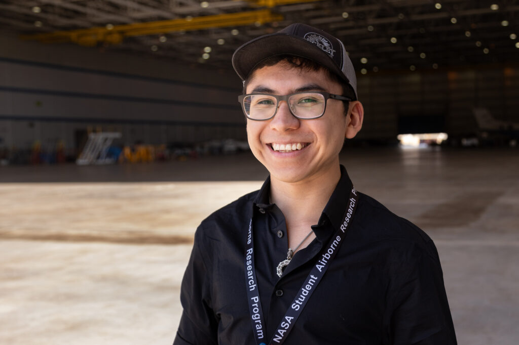
Geology student Ivan Tochimani-Hernandez at Armstrong Flight Research Center. Image: Jane Berg.
Something in the Air
Satellites are one of the main sources of the remote sensing data used for air-quality monitoring. But because satellites like Landsat 8 and 9 are in sun-synchronous orbit, as they pass from the North Pole to the South Pole around Earth, their reading of a given area happens at about the same time each day. Let’s consider imagery over Los Angeles, for example. The image taken by Landsat is at 1:00 p.m., which is not during rush hour in the congested Los Angeles Basin. By moving through the air at many elevations, planes can capture more-complex and more-versatile information.
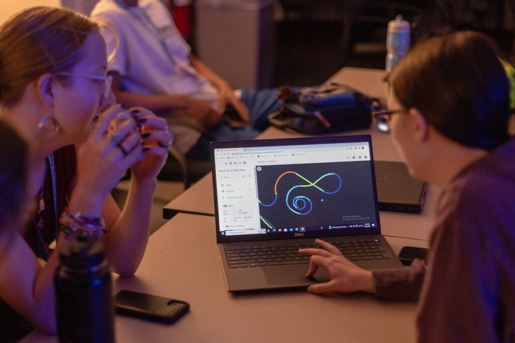
SARP students look at the spiral path of the DC-8 during its first research flight. Image: Jane Berg.
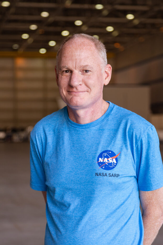
Lefer, who is the program manager of the Tropospheric Composition Program at NASA’s Earth Sciences Division, says that all these different types of data help researchers in their quest to create computer models that are a “digital twin” of a city. Scientists use models in order to visualize data, making it easier to comprehend and also to run hypothetical scenarios. “In the model you can say: what if we reduced the pollution coming from automobiles by 50%? How would that change things?” says Lefer. “But we have to be able to trust the model.”
Air-quality monitoring is vital, but gets less funding than many other older sciences such as meteorological modeling. However, Lefer believes this imbalance is misguided, because “people die from severe weather like a tornado or a hurricane or heatwave, but more people die every year from air pollution than they do from weather—a hundred times more so.”
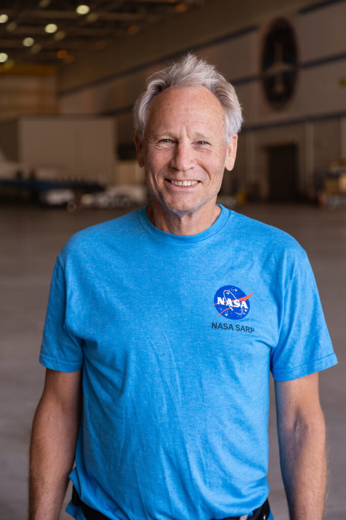
Barry Lefer at Armstrong Flight Research Center. Images: Jane Berg.
On one of the slides from Lefer’s introductory presentation to the SARP interns is a world map that charts air-quality trends over time. For many countries, air pollution has decreased in the last 50 years, something that makes Lefer cautiously optimistic. But progress has reached a plateau due to the fact that many of the “low-hanging fruit” solutions have been exhausted—all the more reason why researchers need data on the sources of pollution that are still running wild.
Changing the Science
Even this short time spent at the AEROMMA and STAQS campaigns has helped me learn a lot about how we collectively affect air quality. Take particulate matter (PM), for example: they are hazardous to our health and have been shown to increase mortality. Other sources of pollution can come from volatile organic compounds (VOCs), which can be found in industrial processes and exhaust fumes but also many household products like disinfectants, perfumes, and cosmetics.
Yet, in conversations at the Research Center in Palmdale, I hear one culprit mentioned more than others: ammonia. Ammonia is a colorless gas with a pungent odor whose name might seem familiar. Aside from its many industrial uses, it also forms as a natural byproduct of protein metabolism in animals. This quite ordinary chemical would have an interesting role to play during the first research flight on Monday, June 26.
Early in the internship, students are divided into four research groups: Oceans, Land, Aerosols, and WAS. The groups are led by at least one faculty mentor and a graduate-student research mentor. Aside from participating in the flights, students also go on field trips to data-rich areas where they can learn ground-sampling techniques specific to their group’s focus area. These trips are also where they tend to generate most of the material that will inform their individual research papers. But for the most part, these expeditions rarely affect the work being done by the broader campaign.
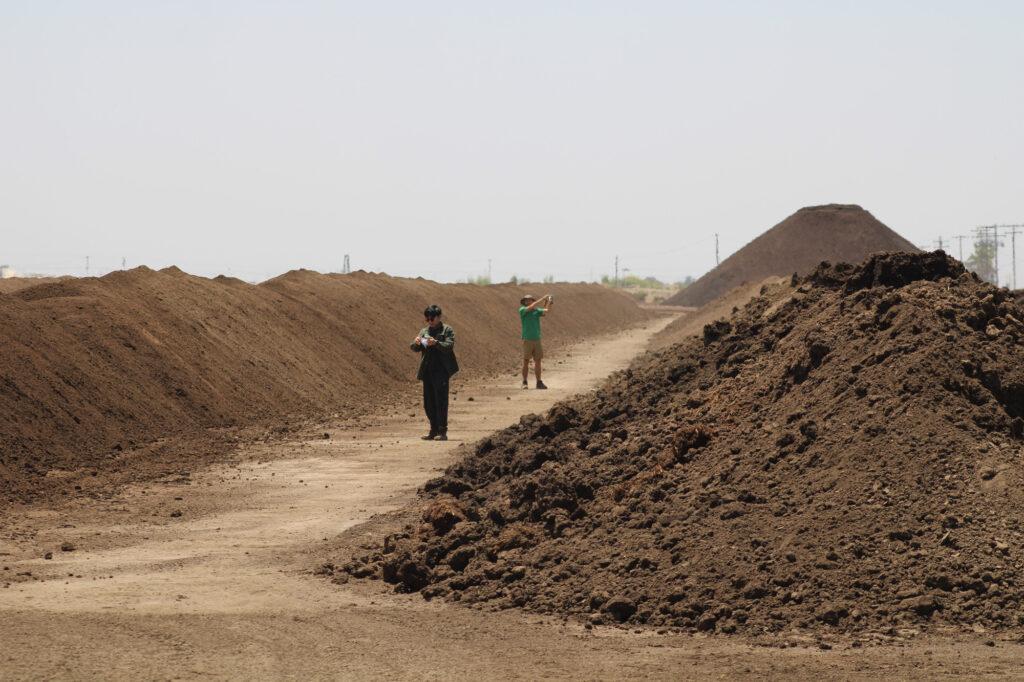
On the first flight day, the WAS group was on one of these short trips into the field, under the guidance of Donald R. Blake, SARP faculty mentor and professor of chemistry at UC, Irvine. They drove two hours north into the farmlands of Tulare County, halfway between Bakersfield and Fresno, to inspect an area they’d been led to believe would have high amounts of ammonia.
This information came from Ann Marie Carlton, a professor of chemistry at UC Irvine. For the last year, she has also been advising the Biden administration’s Office of Science and Technology Policy on climate and the environment, and she is a self-titled “friend of SARP.” When we met earlier that day at the visitor center, she looked unassuming in jeans and a T-shirt featuring a raised fist that read “Green Power,” and I took her for a fellow SARP tourist like myself. In fact, she was there in an official capacity, which is rarely allowed by the White House, but Carlton had convinced her Washington, DC, colleagues that this campaign was an opportunity too good to be missed.
In her research into greenhouse gas emissions from agriculture, she’d spotted something anomalous in the satellite imagery: a single pixel that indicated a dramatic spike in ammonia. It was coming from just one dairy farm in the Central Valley.
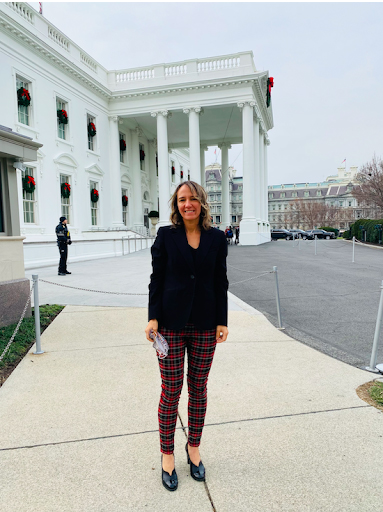
Left: Ann Marie Carlton, who also works in the White House’s Office of Science and Technology Policy. Image: Courtesy of Ann Marie Carlton. Right: Ryan Bennett and Carlton in Building 703. Image: Jane Berg.
Dairy farms are notorious emitters of methane, but their high levels of ammonia are less publicized. Unlike methane, ammonia is not initially a greenhouse gas, but once in the soil it is often converted into nitrous oxide, a greenhouse gas that’s 300 times more powerful than carbon dioxide. While in the air, ammonia is a hazardous pollutant particularly dangerous for those who inhale it on a regular basis, like anyone who works on a farm. Carlton says she became sensitized to the issue by seeing an image in the Sacramento Bee in 2020, which showed farm workers continuing to pick produce, even while large clouds of wildfire smoke could be seen behind them, which highlighted the dangerous air-quality conditions that many agricultural workers face.
This is partly what motivated her to advocate for the inclusion of this pixel in the DC-8’s flight path. Lefer and Yang agreed to help, and Blake thought it would be interesting to take the students to that location and collect ground measurements as well, although he had originally planned to take them to an oil field.
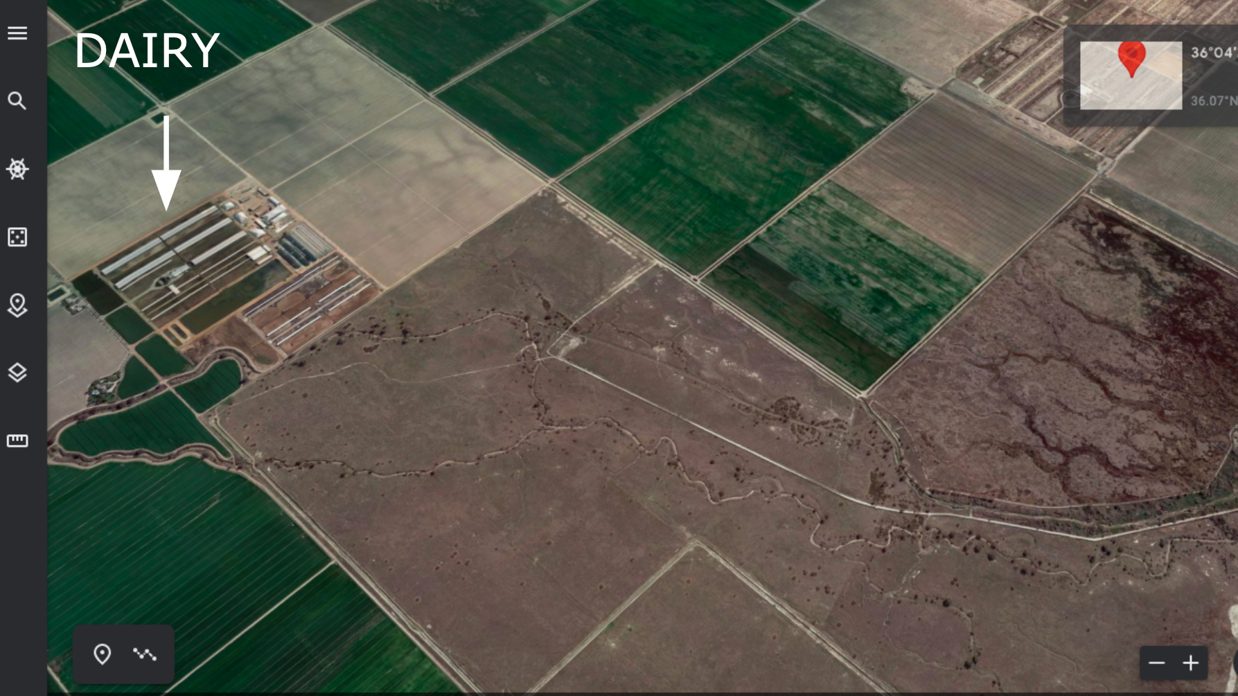
A Google Earth image of the coordinates Carlton identified as having extremely high levels of ammonia. Image: Courtesy of Ann Marie Carlton.
When Blake and the SARP students arrived, they found flat dusty field after field and not much else. Blake thought this was strange. He’d been told to look for a muddy pool full of manure or effluent. The students got out their WAS canisters and took samples anyway, but something didn’t feel right. Victor Geiser, a meteorology student from St. Louis University in Missouri, said he thought they should keep looking. However, despite being just one small dot on the satellite image the pixel still encompassed an area on the ground a few miles wide. Sure enough, after driving around for a short while they found the motherlode.“The piles were about eight feet high, taller than me,” says Geiser.
Manure was heaped in long rows down a field about a quarter mile long and the same distance across. It looked like much of the manure had been sitting for some time, as it was dry and flaking into the dust kicked up by the dump trucks that arrived every few minutes to offload more manure onto the piles. This was without a doubt the place they’d been looking for. Ignoring the “NO TRESPASSING” signs, Blake had the students collect air-canister samples: they lined up and each walked down a lane of what by then they’d aptly dubbed “the shit pile.” Everyone was amused and having a good time, recalls Katie Hopstock, the group’s graduate-student mentor. “They were just running through it having so much fun,” she says. It didn’t smell too bad: about “what you’d expect if you’re driving on a highway, and you pass a bunch of dairy farms. Like cow manure, essentially.”
Blake sent the new coordinates back to the team in Palmdale, and in a rapid series of communications between Carlton, Bennet, and Yang, the mission scientist for that day’s flight, they managed to redirect the plane.
Top: Students use whole air sampling (WAS) canisters to take samples in a field with large piles of cow manure. Bottom: The DC-8 flying over a Central Valley dairy farm, after having changed course, thanks to the coordinates sent by Blake and the students. Images: Courtesy of Katie Hopstock.
The DC-8 had already flown over the area and detected relatively little ammonia. But now the pilots changed course, and the plane flew directly over the field, where the students saw it and waved. According to Blake, this was the first time that a team on the ground had altered a mission, and he says it was an emotional experience for everyone.“We changed the science,” says Blake. “So that instead of detecting virtually no ammonia, they got an amount that was at least 10 times greater than expected.”
At 5000 parts per million, the shit pile had 10 times the amount of ammonia compared to other dairy farms that are already notorious among scientists for having high levels of ammonia. “I think this was the first time that students made a significant impact [to the research],” says Blake.
Earth Science to Action
Don Blake’s reputation avidly proceeds him. By the time we sat down for an interview, I had already heard from students that “Don is the best” and that “he has all the stories,” while Yang had said that working with him was “life changing.” Blake, indeed, seems somewhat sage-like and has a gruff and generous manner. He has been with SARP since the beginning and remembers when the DC-8 was at the NASA Ames Research Center in 2007. At that time, it was not being used as frequently as many would have liked. SARP was a way to bring more funding and interest to the DC-8, which was a senior aircraft then and, shortly after SARP 2023 was retired from service. Blake also had the idea that the program could save money by having the interns live at UC Irvine for the summer, which is where the Rowland-Blake group’s lab is housed.
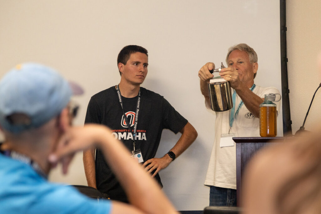
Left: Professor Donald R. Blake at Armstrong Flight Research Center. Right: Blake demonstrates the operation of a WAS canister for students in Building 703. Images: Jane Berg.
In the 1970s, the lab’s founder F. Sherwood Rowland discovered that chlorofluorocarbons (CFCs), man-made chemical compounds commonly used at the time, could destroy Earth’s protective atmospheric ozone layer. Rowland was one of three people awarded the 1995 Nobel Prize in Chemistry for this discovery. The DC-8 had an unsung role in this breakthrough, as it flew on all the Arctic missions that gathered research to prove Rowland’s theory. The disastrous consequences of the ozone’s depletion were averted by the Montreal Protocol, which regulated the phase-out of CFCs, so that today, the ozone hole is actually reducing in size.
In Blake’s view, one challenge when it comes to regulating gases like ammonia is that they aren’t visible. Aerosols can be seen in the air as a haze or smog, but gases are completely transparent. “So when you tell people there’s something dangerous in the air that they can’t see, they tend to think that sounds like fake news,” says Blake. When I meet with Carlton two days after the WAS field trip, she’s on her laptop preparing slides to present to her colleagues at the Office of Science and Technology Policy. She says that thanks to powerful lobbyists, greenhouse gas emissions from agriculture have fallen through the legislative cracks. “If you have a barrel of ammonia at, say, a school or business, then it will be regulated. But if you have the same barrel on a farm, then it’s not regulated at all,” says Carlton.
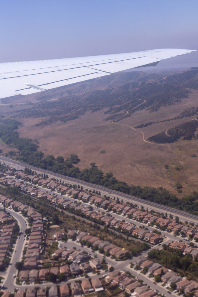
View from a window of the DC-8 as it flies above a residential area in Los Angeles, California. Image: Jane Berg.
The lack of regulation is due to an exemption permitted by the USDA from 2006, which allowed farmers to make a one-time donation to a study that would be conducted on the issue. This donation would exempt them from all civil and criminal liability. The study was meant to take two years, but 17 years later, it has not been completed. What Carlton successfully pushed for was the inclusion of concentrated animal-feeding operations, which includes dairy farms, in a new federal measurement, monitoring, reporting, and verification strategy for greenhouse gas emissions in the agricultural and forest sectors. This will be the first such monitoring network for emissions from these industries across the US.
Carlton says that before meetings between the various stakeholders behind this monitoring network she would “call everyone up” who was going to be at the meeting. “I’d be like, ‘Hey, do you know that there isn’t an animal husbandry component? Don’t you think those should be measurement sites?’ It’s just common sense,” she says. Essentially, she was trying to make the USDA feel compelled to do something. “It’s so hard to change anything…You have to have all of these people pulling and pushing in the same exact direction,” says Carlton. “So now there will be a livestock-management section [in the monitoring strategy], which I feel really good about.”
According to Barry Lefer, the Applied Sciences Program within NASA is placing a real emphasis on “Earth Science to action.” “We’ve done a great job collecting all [these] data, but now we want to make sure that the decision-makers are aware of this,” says Lefer. “We’re not an operational agency, and we’re not a regulatory agency: we don’t set policy. But we want to make sure that those decision-makers are getting the best information.”
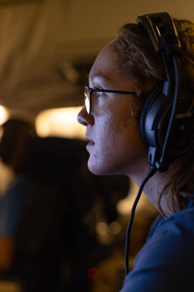
Morgan Selby, associate scientist at the Cooperative Institute for Research in Environmental Sciences, operates the WAS machine during a research flight. Images: Jane Berg.
Final Flight Day
I thought I would have a moment to reflect on all of this during my own flight on board the DC-8. However, the trip turned out to be far from comfortable and contemplative.
Unlike a commercial flight, the pilots on the DC-8 put mission success above comfort. Examining the chart of a day’s flight path is a little like looking at the ECG of someone having massive heart palpitations. The online training we completed weeks earlier warned that due to the aircraft flying low and possibly banking at angles of 30 degrees, the ride could be extra turbulent. Veteran researchers and students alike stock up on anti-nausea medications like Dramamine, and yet it’s never easy to keep the motion sickness entirely at bay. The first flight on Monday morning yielded an impressive 21 motion sickness bags from its passengers.
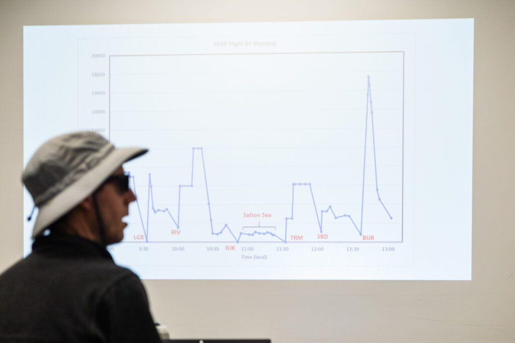
A chart showing the DC-8’s flight path for a flight over the Los Angeles Basin and Salton Sea. Image: Jane Berg.
After a smooth take-off on Wednesday morning, we climbed to about 9,000 ft., which is not that high by flight standards, but only a short while later, the plane started to head for its first “missed approach.” A missed approach is when a plane descends as if it is going to land at an airport, skims as low as it can to the tarmac, but instead of putting down its wheels, hauls itself back into the sky. Missed approaches allow the researchers to get their instruments as close to the ground as possible without having to land at each airport, which would slow things down considerably. The aim is to capture air samples at as many different elevations as possible during the flight, and whatever is happening at ground level is an important part of the overall picture. These approaches, however, can cause some confusion and alarm at an airport, even if they’ve been notified in advance. Because the pilots are often refused permission, they will make a missed approach each time they are allowed by air traffic control.
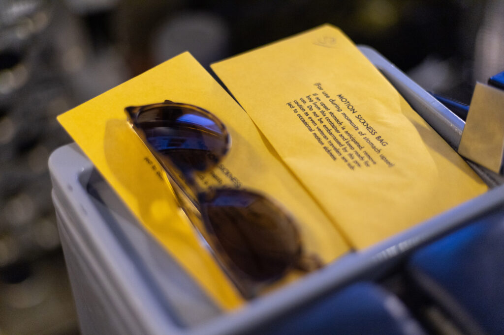
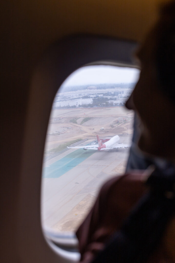
Left: Motion sickness bags on the armrest of seats in the DC-8. Right: A scientist looks out of the window after a missed approach made by the DC-8 during a research flight. Images: Jane Berg.
The first approach was fun, and the second was interesting. But by the time we got to the third, the conditions aboard had become less comfortable. We’d been flying for about two hours by then, and the plane was hot, the temperature drifting towards 90 degrees. Despite being laden with tons of highly sensitive scientific equipment, there’s no AC on the DC-8. If the pilots want to make the plane substantially cooler, they have to climb to a higher altitude where the air is colder. This takes time, however, and can compromise the mission objectives. In our case, we were told to keep the covers on the windows closed and hang tight. Soon, scientists started to complain that their equipment was overheating.
Likewise, I found that the heat was making it harder to keep the creeping sensation of nausea at bay. I became all too conscious of the fact that as the plane descended for a missed approach, there was a chorus of high-pitched squeals that came through the intercom: an apt projection of my inner voice as I fought back the motion sickness. When we headed for our fourth and final missed approach, I began looking down at the motion sickness bags with serious intent.
Now I understand why the end of every flight is a mini-celebration. As people begin to deplane, all the students and staff are waiting for them on the runway. The welcome party stands in two lines and makes a tunnel with their arms, and they cheer as people run through. Few of the passengers, not even senior pilots and researchers, can resist the childish glee of the tunnel.
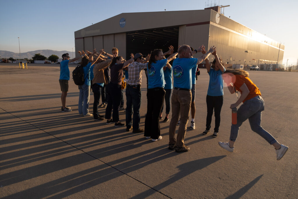
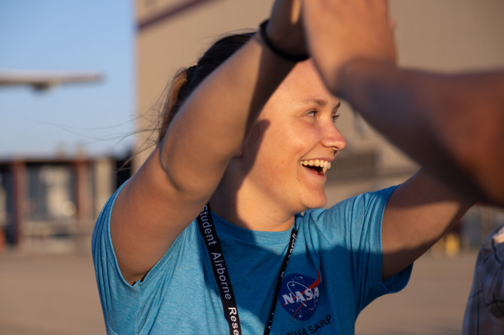
Top: SARP student Christy Harper runs through a celebratory arm tunnel made by other SARP students and faculty after a research flight. Bottom: Emily Rademacher takes part in the celebratory tunnel. Images: Jane Berg.
After the last flight of SARP ’23, the students are whisked away by their mentors to start their field trips. The “Oceans” group is going to spend a few days in Santa Barbara gathering kelp samples. “Land” is headed to Sedgwick Reserve, where they will measure and compare the circumference of trees. “Aerosols” is going to take air samples from the Salton Sea, and “WAS” might go to an oil field. Once these excursions are over, they’ll have to hunker down at UC Irvine for six weeks to write up their findings and finally present their research papers. Hopefully, SARP’s window onto the rigorous and purposeful work of professional scientists will help them find ideas and inspiration for their future careers.
“It’s not just the breadth of the research being done here that’s special. It’s that you are exposed to a lot of different things and different people,” says Blake. “No one fails SARP. You just have to show up and make the most of it.”
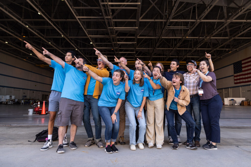
SARP students and faculty pose for a group photo while waiting for the DC-8 to arrive at Armstrong Flight Research Center. Image: Jane Berg.
Having had the chance to experience the highs and lows of flight week, I can see how this brief window into the work of professional scientists can be eye-opening. I’m also left with a strong sense of community, one built by people coming together to learn and share knowledge, as well as undertake the difficult task of quantifying our impact on the natural world.
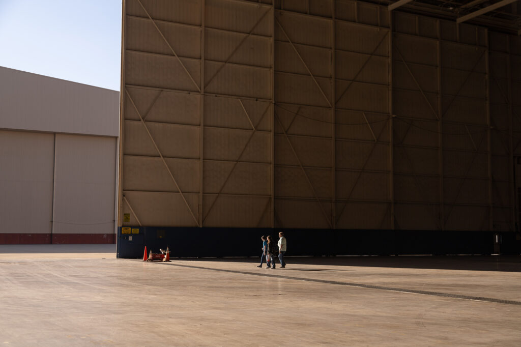
As we all depart on the last day of SARP’s flight week, the sun is setting behind the towering aircraft hangar. The students, laughing as they walk together across the shadowy parking lot, are a bright cluster in their blue SARP T-shirts. Strangers just two weeks ago, they now truly look like a team.
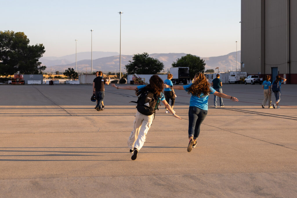
SARP mentors Ana Deegan and Shaina Wilburn make a celebratory exit after the arrival of the last research flight at Armstrong Flight Research Center. Image: Jane Berg.
Related Posts