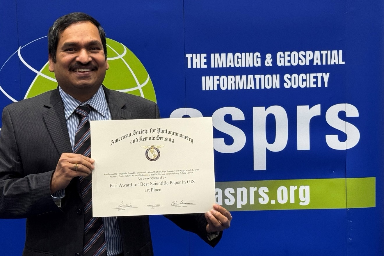
BAERI’s Pardhasaradhi Teluguntla (Pardha) (first author) and his co-authors have received the first place 2026…
Connecting Tribal Lands with NASA Remote Sensing Tools
Remote sensing is a powerful tool — it can be used to map the topography of the ocean floor, track the ash plume of an erupting volcano, or understand drought patterns on tribal lands. As the technology becomes easier for tribal land managers to use, the biggest challenge isn’t navigating the data — it’s navigating the human relationships and conversations about how to make that data more useful.
Listen here or on Apple Podcasts, Audible, Soundcloud, Spotify, or Google Podcasts.
For the Love of Science is produced by the Bay Area Environmental Research Institute. Music by Danny Clay.
Guests
James Rattling Leaf
Carlee McClellan
Amber McCullum
Cindy Schmidt
Nikki Tulley
Learn more
Training Course: An introduction to remote sensing for tribal lands
GEO Indigenous Summit 2020
DSET Fact sheet
More about the DSET project
Connecting the drops — Nikki Tulley
Blending science and tradition
Related Posts