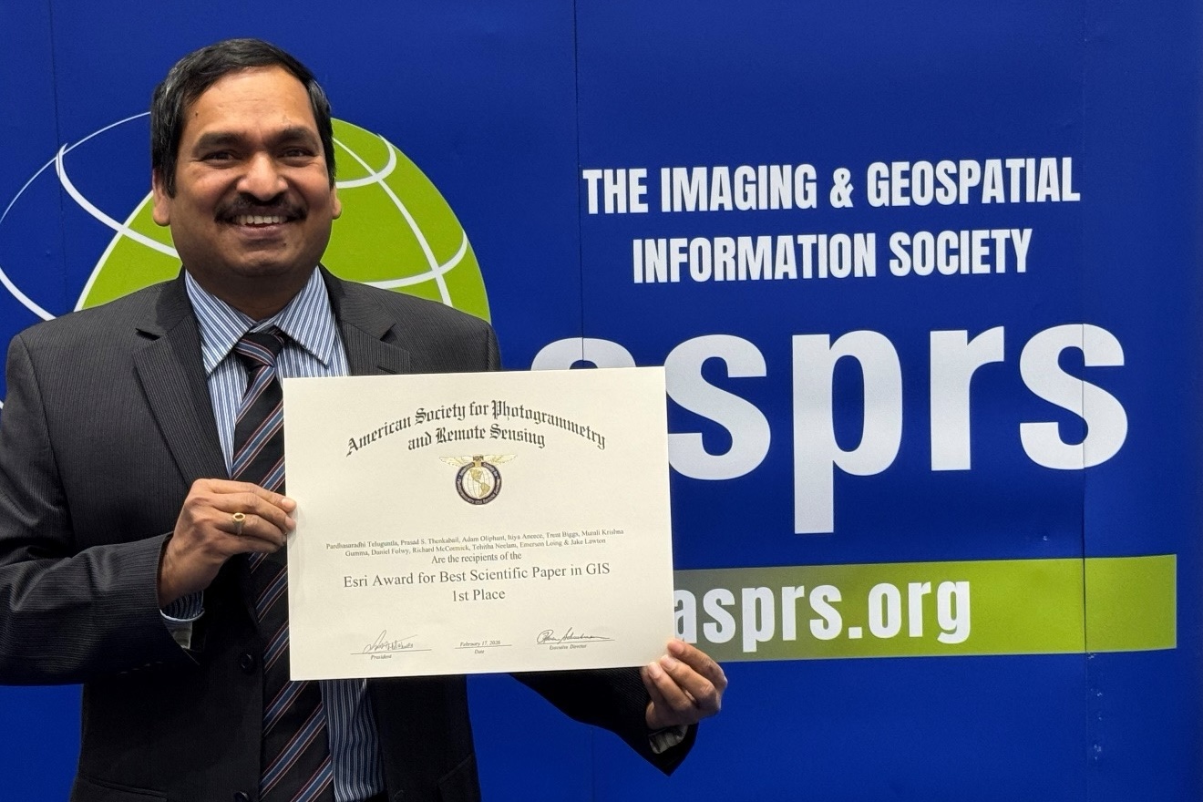
BAERI’s Pardhasaradhi Teluguntla (Pardha) (first author) and his co-authors have received the first place 2026…
What Can We Learn from Remote Sensing Data?
By Rachel Sender
Extreme and unpredictable weather patterns are quickly becoming the new normal—intense heat, flooding, tornadoes, and wildfires have become almost old news as Earth’s climate changes rapidly. To continue moving forward as a species, we will need to adapt to climate change, which will involve developing and implementing more strategic land- and water- management practices. Deciding what steps to take toward such adaptation requires us to couple our understanding of the processes that cause changes to the Earth’s environment with real-time data about how those changes are playing out. Advancements in remote sensing methodologies have led to greater availability of data, which could help inform such decision making.
Remote sensing is the process of collecting data that capture the physical characteristics of an object or area from a distance. Light waves allow humans to visualize surroundings through sight; sound waves are also used for visualization by some species through echolocation. Both sight and echolocation provide a “picture” of one’s surroundings from a distance. Humans have created technologies that mimic and combine these forms of gathering data and have expanded their scale with the use of aircrafts, marine crafts, and satellites for mapping of our landscapes and oceans. Sonar, which uses sound waves to “see” the physical characteristics of a surrounding area, is an example of remote sensing used by marine crafts.
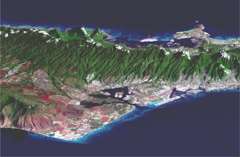
This perspective view combines a Landsat image with topography from NASA’s Shuttle Radar Topography Mission (SRTM). Image: ARSET.
As of 2020, NASA alone had gathered over 40 petabytes of remote sensing data, which can be visualized as a staggering 800 million filing cabinets, and that amount is projected to increase sixfold by 2025. Such data can be used to strategize land and resource management, track climate change, predict weather patterns and natural disasters, and quantify changes to landscapes, whether from deforestation or wildfire.
The availability of more data, however, doesn’t necessarily mean that more people know how to use those data, potentially negating the usefulness. This is why NASA created their Applied Remote Sensing Training Program (ARSET), which offers free online and in-person trainings for anyone to learn to work with different datasets at a variety of skill levels. Their workshops are offered in both English and Spanish. “We really focus on building the capacity of a global audience to use NASA data tools for management issues,” explains Dr. Amber Jean McCullum, a research scientist at BAERI, and ARSET lead trainer. Over 100,000 people from around the world have participated in ARSET trainings to date. “I get goosebumps when I think about all of the people who have come together, engaging with people so far away from you, who you may never have thought would be interested in that topic,” McCullum says.
There is an impressive breadth of ARSET trainings, with as many as 18 added each fiscal year. They are all developed and taught by leading experts in their respective fields who often volunteer their time to collaborate on the webinars. Available topics range from agriculture to water resources, and city planning to air quality. The trainings are primarily developed based on topic requests from participants who reach out hoping to learn a new skill or expand an existing one. Such requests vary from how to use new software to how to apply a new dataset to solve a problem. Each training is unique and offers cutting-edge information.
I was able to experience an ARSET training firsthand, where I learned how existing data can be used to predict where wildfires will occur and then to understand how fires would change those areas. I was especially interested in this training, as my St. Louis summer was colored by stark gray, smoke-filled skies and air quality warnings from fires raging thousands of miles away in Canada.
The training consisted of an advanced-level webinar series that focused on using remote sensing data to assess the impact fires have on the health of surrounding watersheds. Fires don’t only burn down forests and cities or cause smoky air that makes it difficult to breathe, they change the composition of soil and the quality of water as well. Fires reduce plant cover, increasing erosion and runoff, therefore increasing the levels of pollutants within the hydrological cycle.
The series was geared toward organizations and scientists involved in disaster response, ecosystem management, and fire science. To help ensure the training was comprehensible to policymakers and planners who may not have a background in science, ARSET provided suggested prerequisite material. As a non-expert, I perused the prerequisites prior to the training, so that I would be familiar with some of the more technical lingo.
The three-part webinar series took place over the course of a week and a half. I was one of an incredible 804 participants videoing in from 102 countries and 39 US states. The first webinar introduced us to the different types of fires that remote sensing can detect, from high-intensity wildfires that can happen at any time, to seasonal low-intensity controlled burns. Next, we learned to identify watersheds experiencing drought, which may be at risk for wildfires, and the types of data (fire fuel, soil moisture, and temperature) used to identify the severity of that risk.
Fire risk map. Image: ARSET.
During the second session, we learned to compare pre- and post-fire watersheds to understand how their water quality is affected by fires. Specifically, we learned how to use the Soil and Water Assessment Tool (SWAT) to predict the environmental impacts of changes to land use and management, such as replacing water-permeable lawns with pavement, which could increase flood risk. In SWAT, parameters for a given watershed, such as forest canopy coverage or soil moisture, can be altered to represent pre- and post-fire scenarios. SWAT is then able to crunch those data and predict how the watershed will be affected over time because of a burning event, a useful tool for planning best land-management practices. I had to leave this session halfway through, so I was glad to find out that every training is posted to the ARSET website for anyone to access, which I am sure many participants find useful! Because of these recordings, I could go back and refresh myself on methods I might want to try or had struggled to understand.
The third and final webinar session walked participants through the use of Google Earth Engine to detect and track wildfires in real time and then to assess the real-life, post-fire effects. The satellite data used for fire detection and tracking include smoke, temperature anomalies, and light. A fire’s effect is quantified by how much of a landscape was burned (the “burn area”) and by how drastic the damage was (“burn severity”). These are independent factors, as the severity of a fire will differ across a region, based on the variety of the risk factors described above.
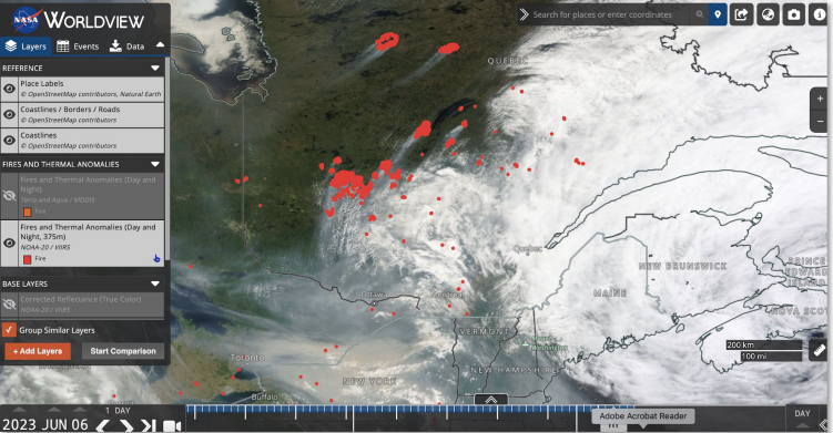
Fires observed from Moderate Resolution Imaging Spectroradiometer (MODIS) and Visible Infrared Imaging Radiometer Suite (VIIRS) in NASA Worldview. Image: ARSET.
After completing the training, I was asked to submit feedback about my experience. McCullum explains that these surveys are one of the ways that the ARSET team decides what webinars to create next. “We really look at those surveys and catalog what types of topics and tools are being requested on a regular basis,” she says. “We use these results when we plan our next fiscal year.”
Webinars are planned a year in advance, so topics are currently being identified and researched for the end of 2024. McCullum explains, “We’re thinking about potential learning objectives, potential structure, [and] delivery mechanisms,” highlighting the amount of meticulous detail that needs to be ironed out for each topic. The guest experts who teach are asked four to six months in advance and will collaborate with ARSET to record their presentations a month before the actual series is launched. I hadn’t realized that all but the live Q&A at the end of each session was pre-recorded.
Currently, ARSET is hosting a training series that focuses on spectral indices for land and aquatic application. If this topic doesn’t excite you, however, new series are listed regularly on their website, so check back soon and learn something new with the hundreds of other people, worldwide, tuning in to ARSET.
Related Posts